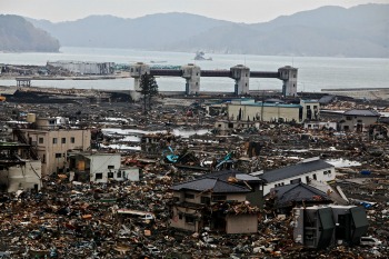
The world experiences far more weather disturbances now than it did in the past. It can be anywhere from hurricanes, tornadoes, floods, earthquakes, volcanic eruptions, and even tsunamis that hit various parts of the world now and then. Irresponsible human activities hastened the arrival of global warming and climate change that in turn messed up natural weather systems and phenomena that steadily gets worse as the years go by. Only then do humans realize how insignificant we are in the face of these natural disasters that already claimed millions of lives since the 1970s.
 These days, social media is instrumental in reaching out to people who live in areas struck by disasters, whether man-made or natural. You can mark yourself safe and connect with family, friends, and thoughtful strangers who want to extend help in times of need. And now, Facebook’s new feature aims to help rescuers and relief organizations (public or private) get to affected areas safely and fast. The tech giant compiles aggregate and anonymous data to paint a clearer and bigger picture about a certain disaster. For years, the social platform has served a crucial purpose of connecting people during catastrophes and the new disaster map can do so much more that in return can save countless lives (both the rescuers and the survivors).
In order to help communities during natural disasters, Facebook has launched disaster maps that use data to help organizations see where people are located and determine what they need.
After storms and other disasters hit an area, traditional methods of communication can be knocked offline and it can take longer for aid and resources to reach survivors. These newly launched maps can help response teams put together a more complete picture of where people are located, according to a release from Facebook.
“We saw people coming to Facebook during disasters to share with friends and family, and thought the trends and how people were sharing on the platform could actually help fill that critical information gap that humanitarian organizations were facing,” the social network’s public policy manager, Molly Jackman, told Mashable. “That way, they [could have] the information they need to respond more quickly and effectively to natural disasters.”
(Via: https://weather.com/safety/news/facebook-disaster-relief-maps-data-recovery)
Maps are helpful in directing everyone on the right course of action when delivering much-needed relief and aid. We can’t stop natural disasters from happening but we can prepare for them although we can’t really tell the extent of the disaster once these disasters eventually strike. It is even more catastrophic in struggling developing nations in Asia and Africa that don’t have existing weather prediction systems in place to warn everyone of a disaster’s approach and what areas will likely be affected, so people can evacuate when necessary.
Maps based on the same concept have been produced from mobile phone company data by analyst FlowMinder. In Nepal, for example, the maps were able to provide clues as to where people dispersed after the 2015 earthquake. However, the sharing and processing of mobile phone data has not approached real time.
According to Molly Jackman, a public policy research manager with Facebook, the new maps have been in development for the past year and are the outcome of extensive discussions with humanitarian organisations. “They helped us identify the data that would be most helpful for them,” said Jackman, speaking to IRIN over the phone from Facebook’s Menlo Park headquarters. “A lot of the conversation started with Safety Check; at first they just asked us to aggregate that data. The challenge we quickly realised is that a lot of people may not be looking at their phones or checking in as safe. So we wanted to dig a layer deeper.”
The map will allow rescuers identify which areas are safe and which ones are not that can facilitate disaster recovery and in rescuing possible survivors trapped inside the danger zone. The map can also tell whether which direction survivors are evacuating to, to let rescuers know where to concentrate their relief efforts. Facebook has spent a great deal of time developing this disaster map to make sure that whatever data they get will prove useful in times of disasters without compromising the privacy of the people using these maps.
